|
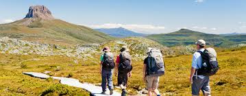
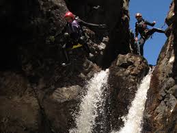
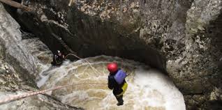
In the past year (June '14 - June '15), over three million people from all over the world chose to come to Australia for the purpose of a holiday. Australia is a popular tourist destination because of its unique flora and fauna, its beautiful warm weather, and of course, its internationally recognised landmarks. Australia is full of man made and natural landmarks. The most popular man made landmarks include the Sydney Harbour Bridge, Sydney Opera House and the Australian War Memorial. Some examples of natural landmarks are Uluru, the Twelve Apostles and Cradle Mountain. Cradle Mountain Location: Lake St Clair National park, in the Central Highlands region of Tasmania. It's longitude is 41.6846 degrees South and it's latitude is 145.9513 degrees East. Cradle Mountain is located 329km from Hobart, 1, 422km from Sydney and 2, 857km from Uluru, NT. Description: Cradle Mountain was named Cradle Mountain by Joseph Fossey in 1827 after its similarity to miners cradle. Cradle Mountain rises to 1545m above sea level and its area is 124, 942ha. It is made of Jurassic dolerite, similar to other mountains in the Lake St Clair area. Cradle Mountain was listed as a World Heritage national park in 1982 because of its incomparable natural beauty, its unique flora and fauna and its fragile alpine environment. Cradle Mountain is considered valuable because it contains lakes and valleys formed by glaciers in the past 2 million years and Cradle Mountain is home to many threatened species that are already extinct on the Australian mainland. These species include pademelons, Bennett's wallaby, Tasmanian devil, Orange bellied parrot and the Eastern quoll. Discussion (how it was formed): The Cradle Mountain area is one of many breathtaking geological contrasts. The Cradle Valley, where the famous Cradle Mountain is located, has been formed and altered by geographical processes in the past 2 million years, over three glacial periods, the most recent one was the last ice age (10000 years ago). During this ice age, a huge 6km ice cap formed. The glaciers created from this ice cap flowed from the mountains edges. The size of the glaciers and their incredible erosive powers carved the landscape into the shape of a miner's cradle (which is why it's called Cradle Mountain). The glaciers amazing power formed Cradle Mountain and made it on of the most spectacular sights in Australia. Ridges and mounds in the valleys surrounding Cradle Mountain were created by boulders, rocks and gravel that remained on the ground as the ice melted. As well as dramatic mountain landscapes, the ice left behind over 4,000 lakes throughout the Central Plateau. The glacial features that the glaciers have left behind include the U-shaped valley in the Dove River. The Dove River is a 4km stream flowing through a remote quartzite gorge. The Dove River is a popular place to kayak. Cradle Mountain Canyons Tours lead adventure tours in the Dove River area. These tours include activities like abseiling and are ideal for people with a great sense of adventure. The first human settlement of the Lake St Clair and Cradle Mountain regions was when the local Aborigines moved into the highlands as the glaciers began to recede. Archaeological research suggests that the Aboriginal people spent most of their time moving through the valleys, with occasional visits to higher areas. The Aboriginal peoples extensive use of fire to clear paths in the past are shown today by the vast button grass plains. |
|
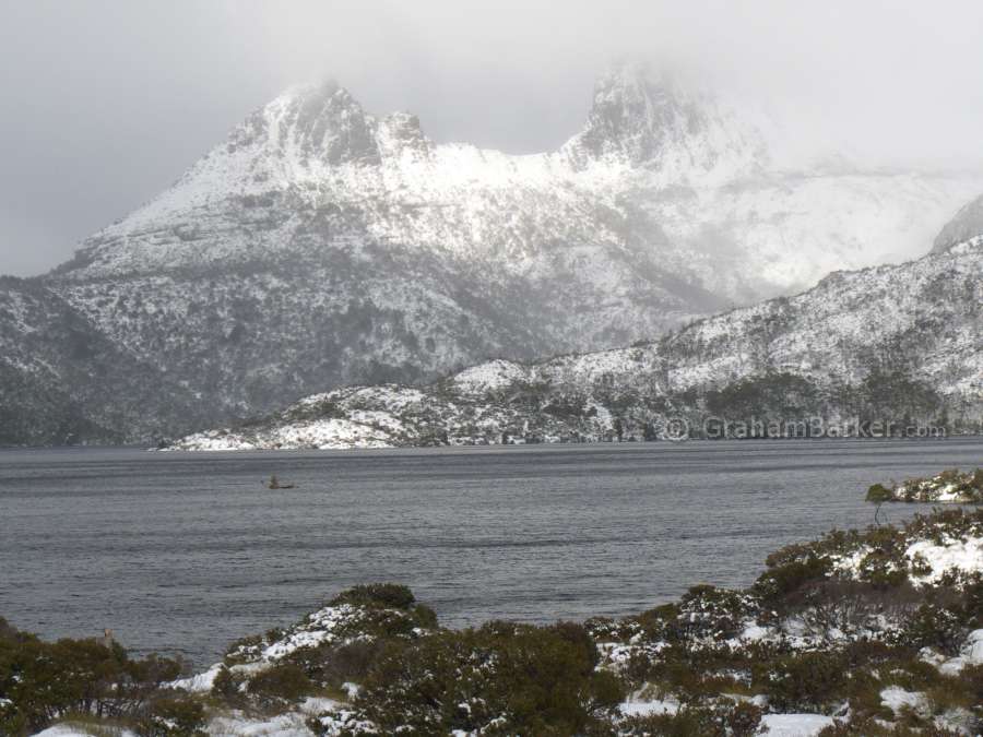
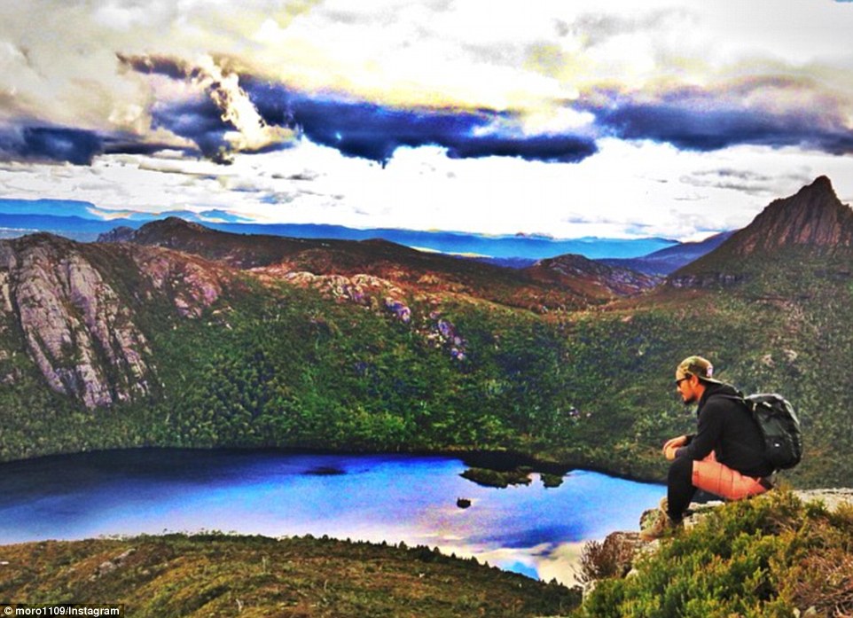
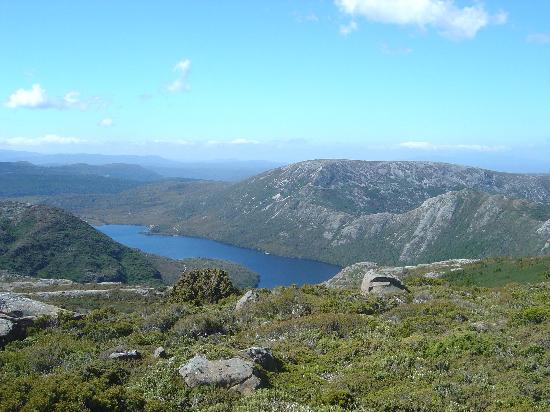
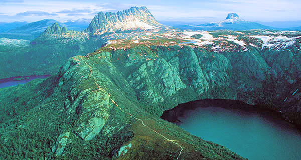
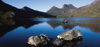
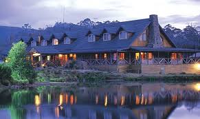
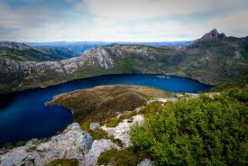
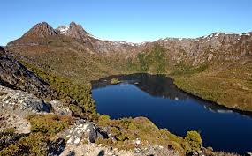
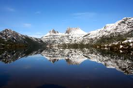
The images above show the view of Cradle Mountain from the sky (oblique aerial), the ground, the top of the mountain and the view from Lake St Clair National Park lodge.
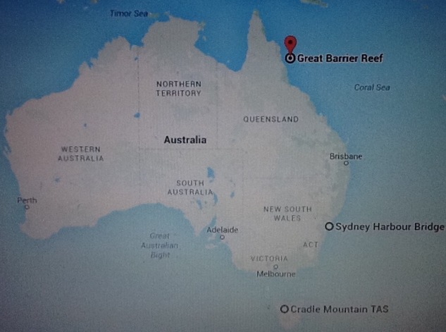
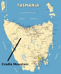
The map above shows where in Australia Cradle Mountain is , and also where it is in relation to two other significant Australian landmarks- The Sydney Harbour Bridge and the Great Barrier Reef. These three attractions are some of Australia's most popular tourist attractions.
